Great Himalaya Trail, The Real Adventure in Himalaya
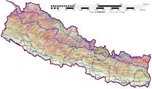
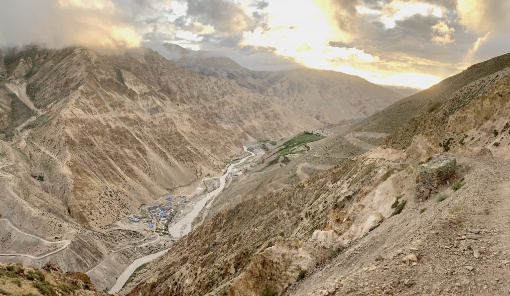
The Great Himalaya Trail is a trekking route across Nepal which includes total length of roughly 1700 kilometers from east to west in Nepal Himalaya. It is one of the longest adventurous highest altitude trekking trails in the world. GHT covers the established trekking trails along the foot of the Himalayan range and cross many passes as well. There are 2 routes Upper and Lower in the GHT. The Great Himalaya Trail mainly focuses on Upper route which is technical & Adventurous trail and crosses many high passes on the trail. The upper route passes from Kanchenjunga in the East to the Tibetan (Chaina) border Hilsa 3642m in the West (nowadays talking to end GHT at Mt. Api in far west Mountain of Nepal). It is great chance to see 8 of 14th above 8000m mountain including world’s highest mountain Sagarmatha (Everest) too. Upper route takes around 122 days to complete this trek in 1 season and it takes around 62 days each to complete in 2 seasons. The route also crosses 2 passes above 6000m and 14th passes above 5000m including Daldong 5562m peak. From adventure point of view, it can be considered as the longest adventurous trail in world. It is a great attraction for the tourists who are fond of adventurous destination.
As GHT is a long and rough trekking trail, there is an alternative route for the ones who love to trek. There is an option of choosing lower route. The lower route passes through the mid-hills of the Nepal with average altitude being 2000 meters above sea level. There are many passes too. This route is about 1500 kilometers and takes roughly about 120 days to complete the trek. This trek can be refreshing as one can blend in with nature and enjoy the diverse yet beautiful landscapes.
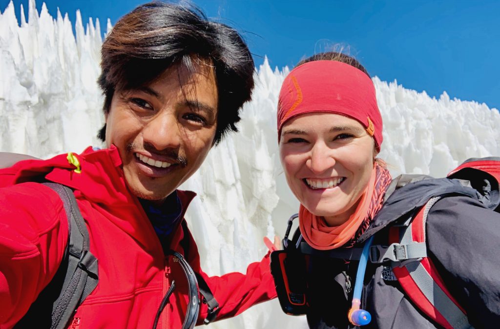
As for me, I had the chance of experiencing GHT twice in the upper route. My first experience is divided into segments. First, I trekked continuous from Hilsa to Jomsom. Then I trekked in Annapurna, Manaslu, Langtang, Rolwaling, Everest, Makalu and Kanchenjunga in different seasons. However, in my second experience I got the chance to complete GHT in just 1 season with Swiss trekker Maria-Theresia Zwyssig as her guide.
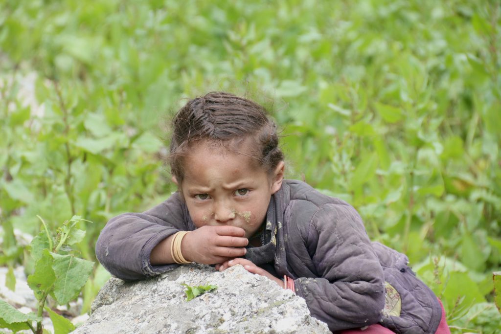
We started GHT with Maria-Theresia Zwyssig from Mt. Everest regionand continued to Hilsa in the west. The trail is along the foot of the mountains and upper hilly region. We crossed many high passes as well. We also had the chance to witness various cultures like Hindu, Buddhist Tibetan and Bon culture. Most of the places along the trail are wild, less explored and the civilization is also less compared to other parts of the country.
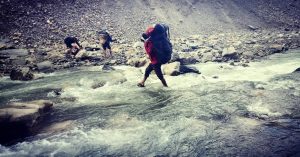
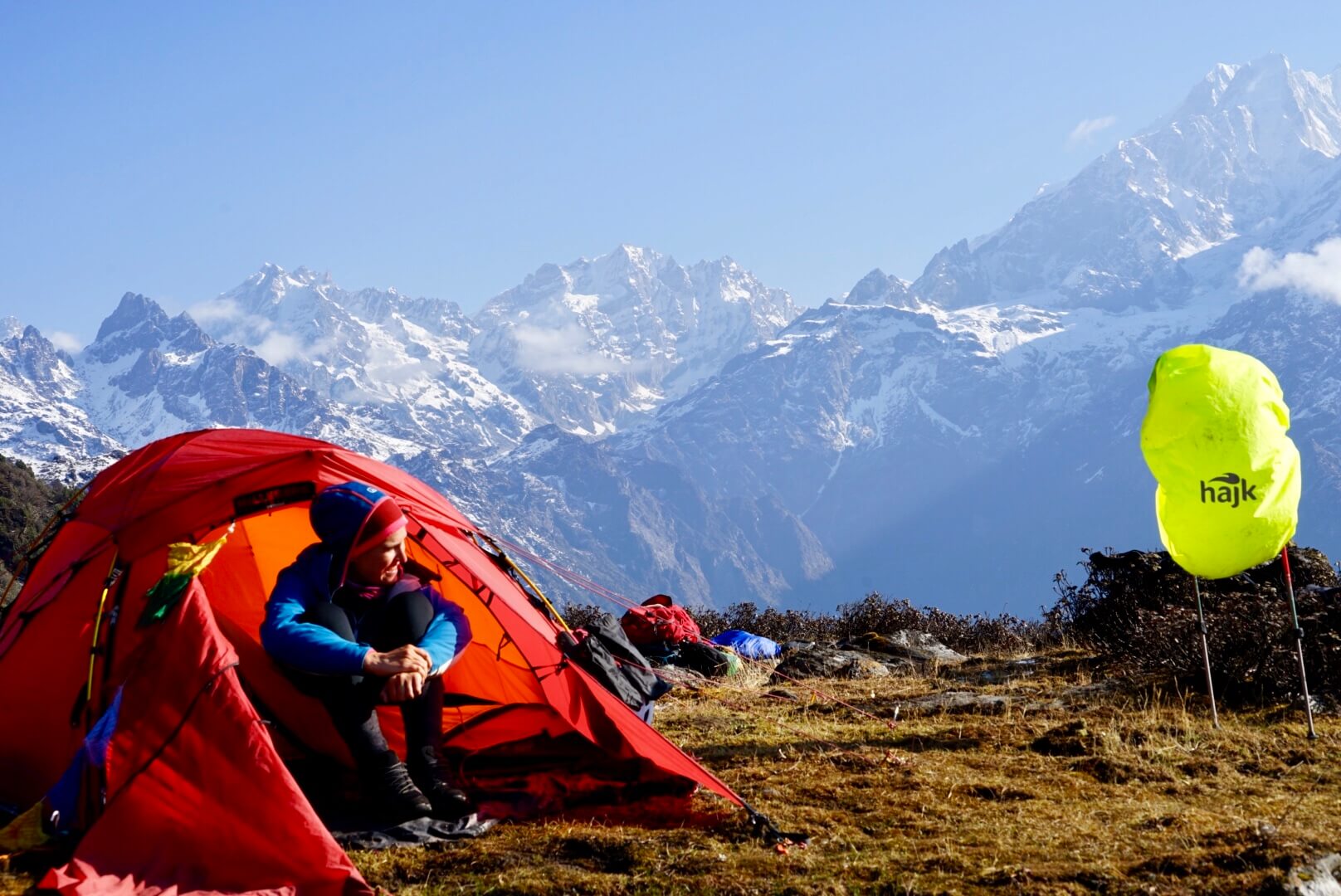
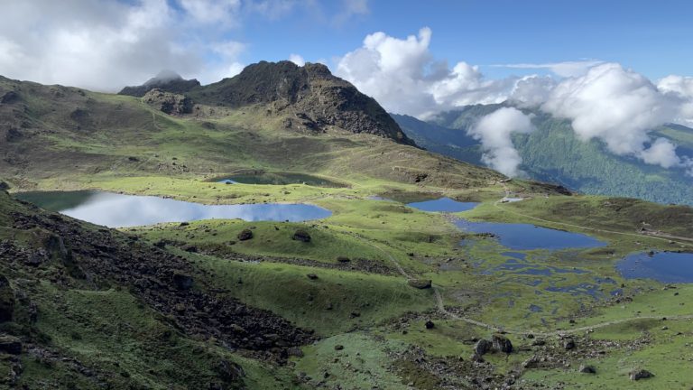
We did the GHT in two phases. First, we completed the journey from Namche to Hilsa and in second phase from Lumba Sumba to Namche. We started our amazing trek from Lukla and went through the Cho La pass 5420m, Gokyo Lake and Renjo-la 5360m with the absolutely magnificent Mountain View along the trail and reached Thame. Lukla-Namche-Pangboche-Thukla belong to famous Everest Base Camp Trekking Trail and Cho-la, Renjo-la belong to famous three passes of trekking trail in Nepal. We see Mt. Everest world’s highest mountain, Mt. Lho Tse world’s 4th highest mountain, Mt. Makalu world’s 5th highest Mountain and Cho-Oyu above 8000m mountain between this trail and magnificent mountain view and Gokyo Lake.
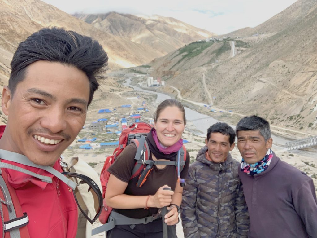
From Thame we hired 2 porters to carry food and tent for further GHT journey. At this point we were thoroughly acquainted with the typical Himalayan terrain and we finally crossed Tashi Labstapass 5654m to reach Rolwaling. Tashi Labsta is one of technical and risky passes on the trail. We were fully equipped by climbing gear, we did it but still we had to cross big glacier to reach Chho Rolpa Lake. I am grateful to our assistant Khamsung Sherpa and Pasang Lopchang. Especially Khamsung, they helped us to cook food, carry food & tent and helped to fix rope. It was our 1st sleep in tent on GHT journey. Next was Village Na after 3-night tent camp and it was a hard part of our journey. We arrived late in the evening, moreover we hardly got place in a guest house. Our same team continued till Last Resort through Rolwaling valley, Ladulk, Bigu Gumba, Palati Jyangdang and Bagam. We saw mixed culture Buddhist and Hindu. At some place we slept in local house, sometimes at cow shed and sometimes in a tent. The great part was that we enjoyed the culture, local people and amazing landscape.
Further we made our way with another team Nima Lama and Lakpa Lopchang along the Himalayan trails to reach the gorgeous and Tibetan influenced Langtang region. On our way, we cross Pach Pokhari and passed the 5295m Tilman pass which is technically challenging and therefore required mountain equipment again. After we crossed the pass, we were rewarded with stunning views of the surrounding mountains and valley including Langtang Lerung, Langtang-Ri, Ganchenpo and more.We ended our GHT Langtang trekking route at Syabrubesi. We continued with same crew to Machha Khola route to Manaslu trek through Tamang Heritage and Rubi valley enjoying Tamang & Gurung culture.
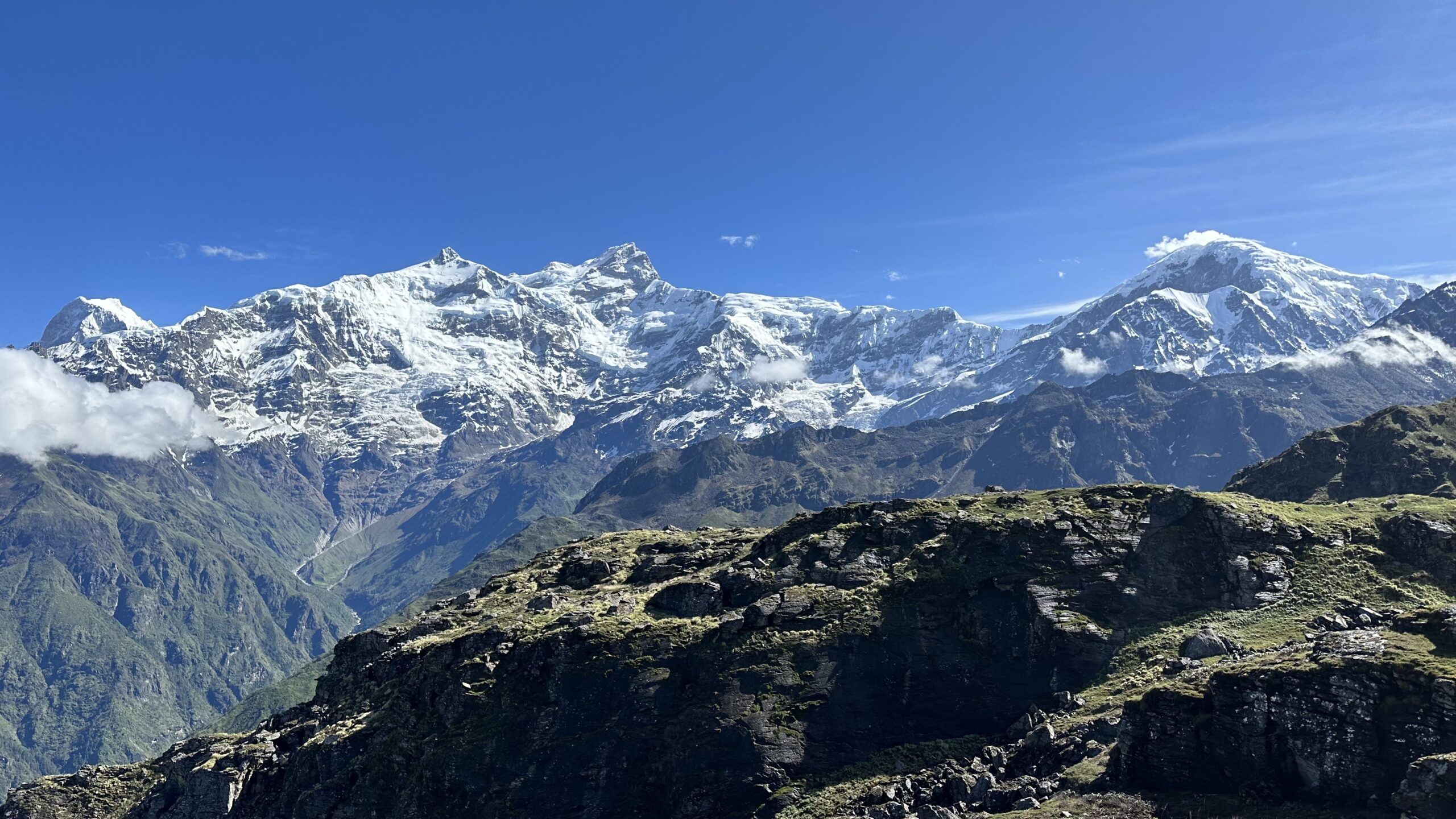
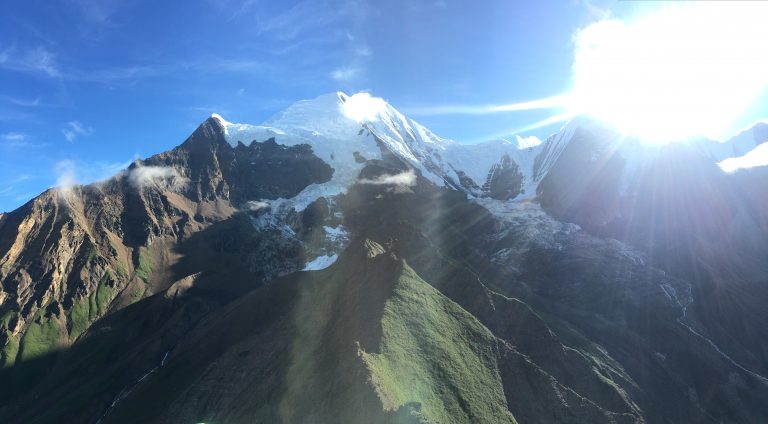
We walked along the slopes of Larkya pass trek (Manaslu Round Trek)with our new assistant Aitaram Ghising. It is an increasingly popular trek which is not as crowded as the Annapurna Circuit or Everest Base Camp. We passed exceptional alpine grasslands and Buddhist villages. The beautiful village of Sima gaon situated at the lap of Mt. Manaslu and the Larkya Pass 5154m along with incredible Mt. Manaslu 8163m view made it more exciting and Annapurna I 8091m.

The spectacular Annapurna Circuit is one of the most popular trekking routes in Nepal. The Annapurna Circuit does provide an extremely close encounter with Himalayan terrain and extremely beautiful views of Annapurna Mountain range, Gangapurna, Tilicho, Chulurenge and Mt. Manaslu. Moreover, we were always within walking distance of comfortable lodges and tea houses. With Aitaram we made it through Throng-la 5416m pass crossing Manang village which is known as land behind the Himalayas (Himala Pariko Desh).After Throng-la we entered Mustang District to Muktinath Pilgrim place and Kagbeni also known as Kali Gandaki valley which is an incredible village with beautiful landscape.
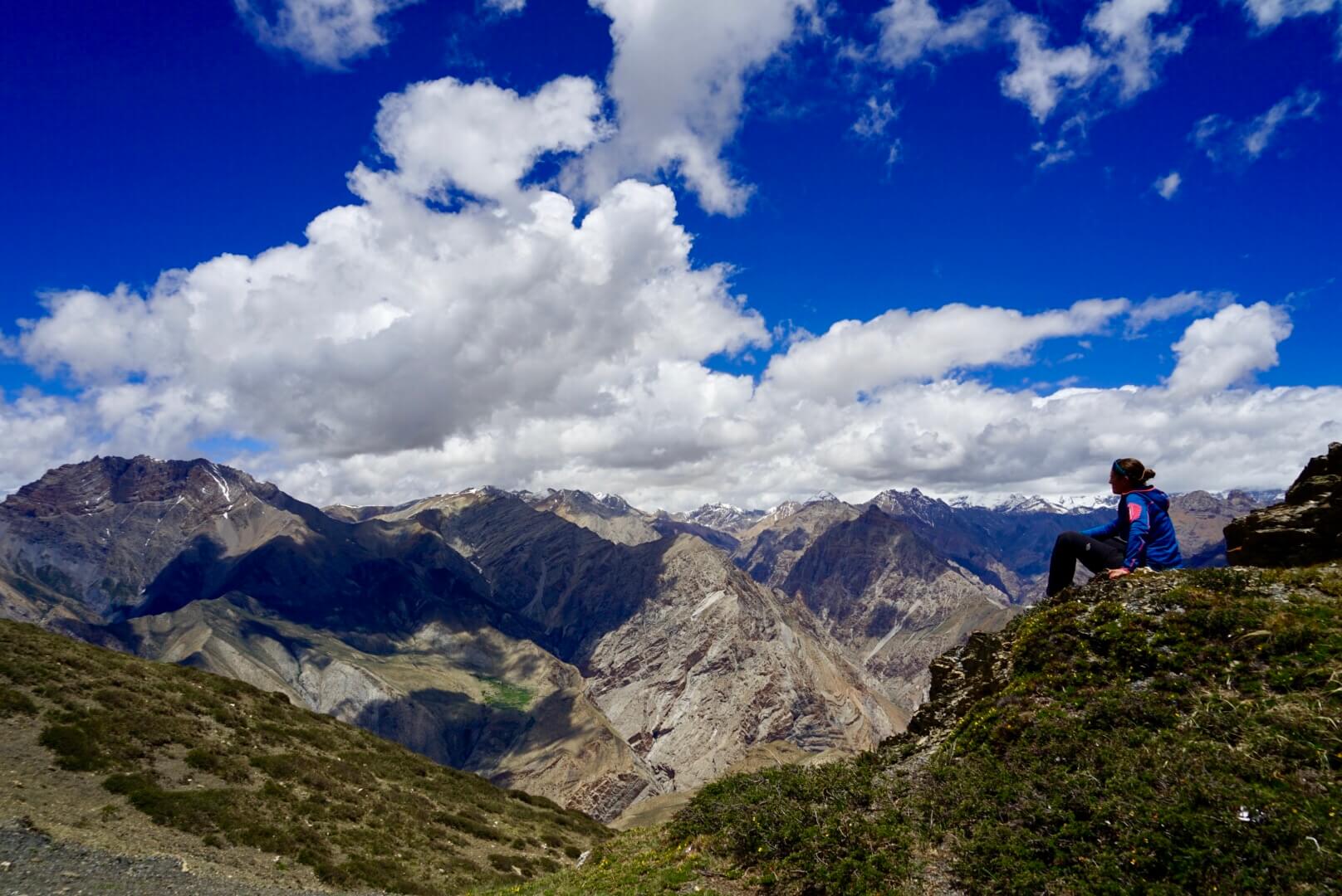
At Kagbeni we added 2 more staffs Pasang Temba Tamang and Nime Lama with tent and camping food. We were changing porter/assistant time by time because we were walking for many days without stopping a day and it would be difficult for porters to continue with load for longer days. At the same time, they would bring permit and necessary documents too. We again started camping from Kagbeni and climbed to Dhuse-la 5552m via Santa village Tibetan culture. We were heading towards more dry land area with less plant and wide area. The weather was great which allowed us to witness stunning view of landscape and amazing view of Mt. Dhaulagiri 8167m. After Dhuse-La we entered Upper Dolpa. It is one of the most culturally fascinating places in Nepal similar to Tibetan platinum & culture.
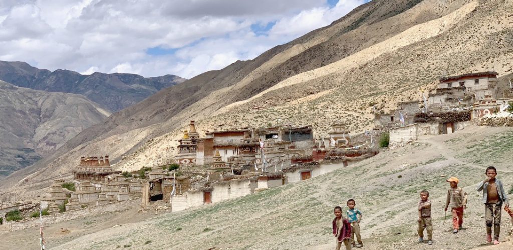
The people of Dolpa live in the highest villages in the world, with the Himalayan giants watching over them. The most amazing thing people go to see here is the old Bon & Buddhist monastery& culture which is beautiful and enormous. Chharka-bhot is 1st village after Santa with Buddhist culture and own traditional dresses. Next other high passes were Mo-la 5021m, Muri-La 5061m and Neng-La 5390m in Upper Mustang which gave us wild adventure, panoramic mountain and incredible landscape view. This trek had us walking in the barren yet beautiful terrain of Dolpa. Along the trail we crossed different villages and big historical monastery Yangtser Gumba. It is amazing and incredible Buddhist Monastery in Nisal Village. In Upper Mustang every village has its own monastery. However, Pu Gumba and Bijer village Gumba is more attractive compared to others but not as Yangtser Gumba. Our Team enjoyed the local food, people and landscape different than other.
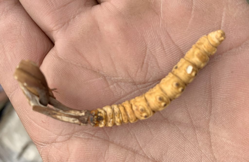
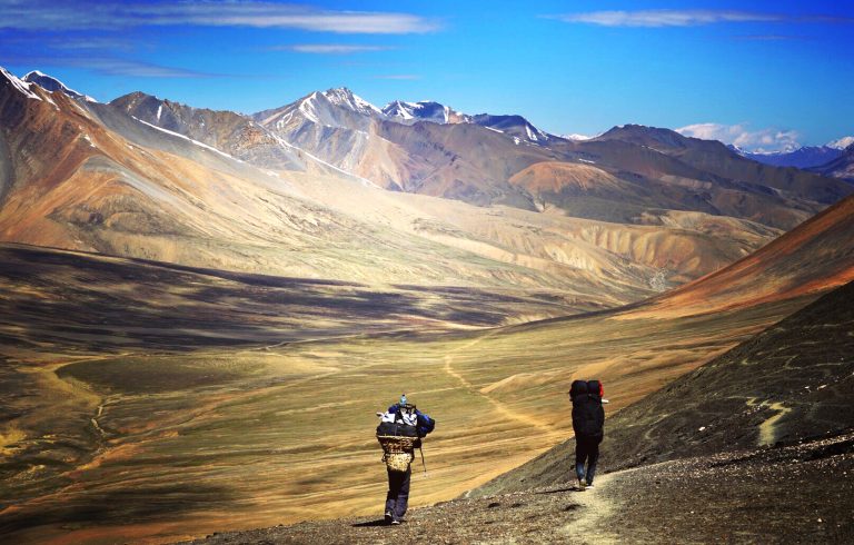
We walked to Mugu from Dolpa which was a great experience. We crossed 2 passes above 5000m and one 5562m peak in this part and between these parts there were no any villages. It was wild and close to Tibet border in a foot of mountain trail. Along the Dolpa Mugu trail Phot village was last village and no village till Siran Chaur in Mugu. At Dadong peak 5562m weather was not good and trail was covered by snow and ice. We took ridge way down. It was bit challenging for us but we did it anyhow. We were too tired to reach to our camp and it was already getting dark. Next day we found people collecting Yartsa Gumpu (Cordyceps Sinensis) at Pung Kharka, it was so lucky to see the famous Yartsa Gumbu and how they collected it. Yala Pass 5403m is the Border of Dolpa and Mugu; it gave us amazing Tibet Border Mountain view and sight of valleys. At Mugu site around Maryongthang, there were also a lot of local people collecting Yartsa Gumpu. It was June, the most suitable season for Yartsa gumpu which is most expensive and beneficial. Chyarko Pass 5143m, it was last above 5000m pass in this section. We arrived at Gamgadi via Pulu, Mangri (after Mangri start Hindus Culture) and we made amazing Rara Lake (Nepal biggest Lake) sight-seeing from Gamgadi. From Gamgadi, Pasang went back home and rest of the team continued the GHT.
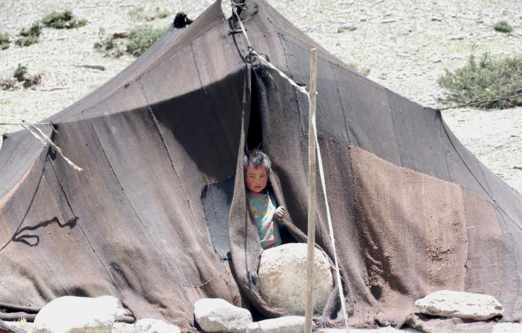
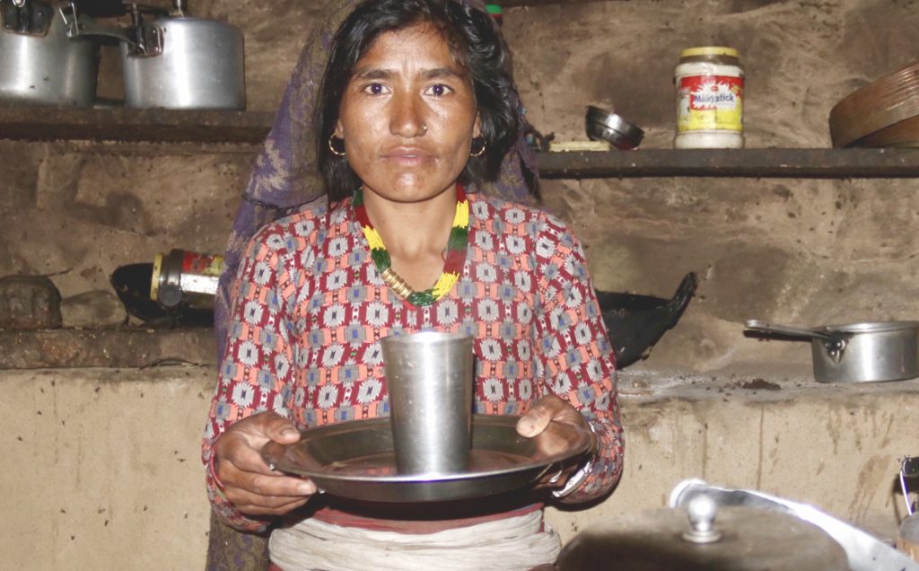
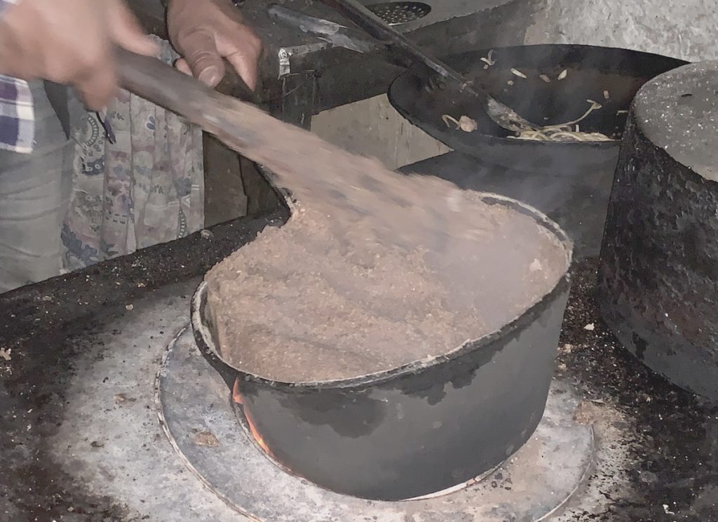
Our trek continued to Humla, Simikot. During this trek, we saw poor village with poor sanitation and people believing in superstitions. I have never seen that much flies in a house before. We started seeing flies already from Pulu and while we walked along the ancient salt trading route to Humla. It was great, as people were kind, helpful and they had their own culture which we saw closely. We stayed at Local house and had their local food what they cooked. It was summer and farming time and we witnessed how they farmed over there. There was greenery, up and down local typical house and Margo Lek 4021 was high place in this part.
From Simikot to Hilsa was the last part of west Nepal GHT. We did Limi valley first and back to Simikot from Hilsa. In Humla, we got to experience unadulterated Himalayan culture. The terrain first contains green pastures, which then transform into barren land divided by magnificent valleys. We did Lekdingga, Nyalu 4989m pass to Limi valley. One of place where you can see Mt. Kailash from Nyalub if weather supports you but Didn’t had this chance. At alpine zone, we stayed at Yak shed and crossed Jang, Halji and Til Tibetan village and we also observed culture with historical monastery. Finally, we arrived Hilsa last point of GHT and border with Tibet (China). We arrived at dusk and though we were tired, we were very excited at arriving Hilsa.
From Hilsa we went back to Simikot via Nara Pass 4541m crossing Yari, Muchu, Yalbang, Kermi and Dharapuri village. There is all the way jeep road to Simikot from Hilsa. We completed our first phase of GHT.
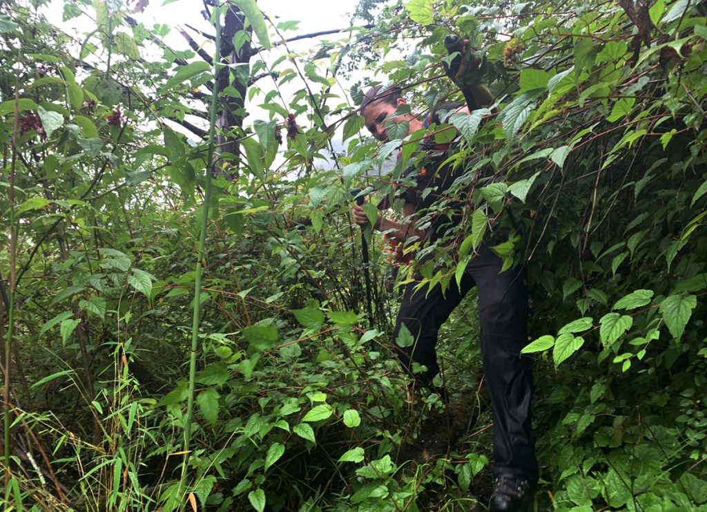
In our second phase, we started our journey from Lumba Sumba. We enter on a region of Makalu right after traversing Lumba Sumba Pass 5161m merging Kanchenjunga and Makalu Barun National. We were in the eastern part of Nepal in mid-summer. It was rainy, muddy and slippery as well as greenery too. Our trek became difficult between Thudam and Chyamtang as the trail was solely covered by jungle and the rain made the trail slippery along with horrible leeches which I don’t want to even want to remember. It was most horrible and hard part for us. Arriving at Ridak, it was late evening around 9pm with lot of leech. We found 1st house and asked for overnight stay but woman from house switched off the light as she might have been
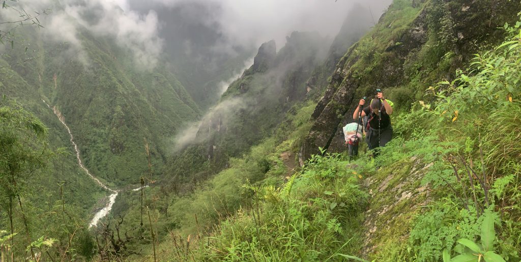 afraid. Later she allowed us to stay and gave us food too. She was great. We collected 100 of leeches from our body. That evening was rainy and we encountered uncountable leeches. At some point, I thought by blood will be finished soon. Chyamtang and Hungung have Bhote culture which you can’t see in any other places. They have their own culture, dresses and language. Hungung to Makalu Base Camp trek was also horrible because of rain, slippery & muddy trail and summer flooding rivers. This part of the GHT was quite difficult because of narrow trail, jungle and bad weather. We walked through Mulung Pokhari, Salding Kharka, Thulo Suntali to Yangle Kharkha where we met Makalu Base Camp trail.
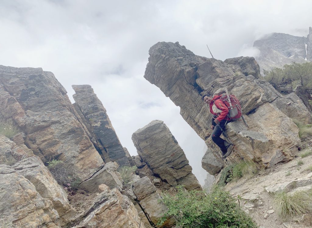
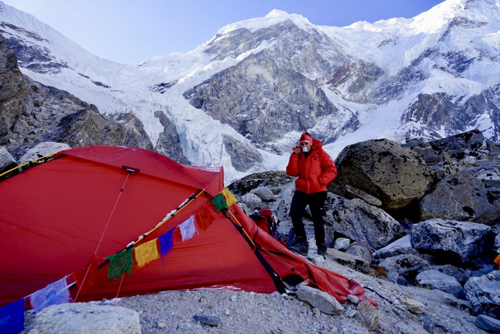
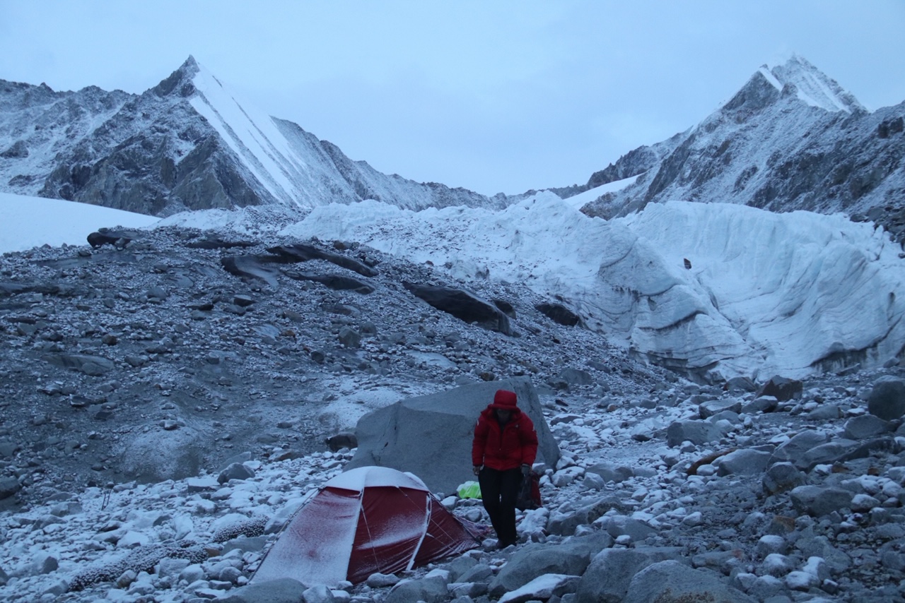
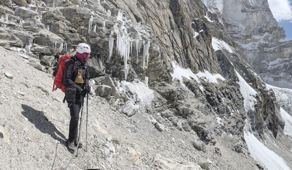
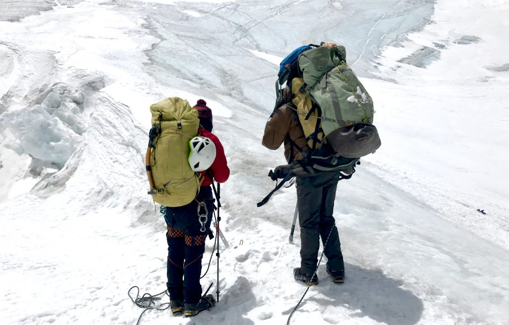
After Makalu Base Camp we headed towards Sherpeni Col and west col to Everest Region. We saw Amazing view of Mt. Makalu world 5th Highest Mountain in front of our eyes. We planned to cross Sherpeni-col and West-col on same day but we couldn’t success. We were equipped with all climbing gears because it is the highest pass, dangerous and very technical too of GHT and a big glacier is also here. We did Sherpeni Col 6193m and walked towards West-col via glacier. Between glaciers we could see open and hidden crevasse. Maria was afraid and she felt cold feet on the glacier. It took us a lot of time as weather was bad already. Sometime my leg would go down to hidden crevasse, it made my client and staff more afraid. We could not cross West Col 6131m, we camped at 6100m altitude in a glacier. Next day, in the early morning we crossed west col 6131m but  unfortunately at the end of cliff Aitaram had an accident. He was in rope, where I Bley him to go down but all the rock where he held and where he placed his foot fell down in his body, luckily rope wasn’t broken. That was god bless, he does not have any open wound so far but his body was in very much pain. We offered to carry him but he preferred to walk down. Next day weather was too bad that even helicopter was not able to fly over there. With the same condition we did another hard pass Amphu Labtsa pass 5848m. It has big glacier and steep cliff.
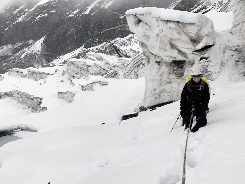
We entered Everest Section of GHT which is home for three eight thousanders i.e. Mount Lhotse, Mount Everest and Mount Choyou. This trek was the most challenging part of the entire Great Himalaya Trail as we crossed three high passes among which two of them are over 6000m. This is the highest altitude terrain you’ll have to traverse in the whole GHT. While the untouched nature around Makalu is a special highlight of the trek, we can’t forget the challenging “Three Cols”; Sherpani Col, West Col and Amphu Labsta which we had to cross to reach Lukla.
Experience of GHT is very precious for me as a guide and as a person who loves adventure trekking. I along with Maria was able to explore the Himalayan and upper hilly region of Nepal. We faced many hardships on our journey but still we were determined to complete it anyhow. As from my experience, it is hard to complete GHT in one season because weather is not always on our side. However, there is a different kind of satisfaction in completing the GHT in one season. I would suggest completing it in one season if possible; otherwise one can complete it in different seasons. Who love wild adventure and nature including glacier should do Great Himalaya Trail once in their lifetime and real adventure in Himalaya.